The storm's path
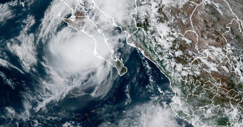
Hurricane Polo is officially shaking things up. After hitting Category 3 status, the storm is slamming into Mexico’s Baja California Sur and Sonora, bringing life-threatening winds and flash floods with it. Forecasters at the U.S. National Hurricane Center say the storm is set to track inland and pivot, sending a massive plume of moisture straight into the Southwest U.S.
What this means for you
Real talk: the vibes are off for anyone in the storm's path. We're looking at flash flood watches across 11 states—including Arizona, New Mexico, Utah, Colorado, Kansas, Nebraska, Iowa, and Texas. Over 14 million people are currently at risk. Cities like Phoenix, Albuquerque, Dallas, Oklahoma City, and Omaha could be dealing with serious flooding for the next three days. Experts are predicting 3 to 6 inches of rain, with some areas potentially seeing even more.
Staying safe
Authorities have a simple message: don't test it. Never drive through floodwaters, no cap. The storm reached extreme levels of rapid intensification earlier this week, with wind speeds that skyrocketed from 45 mph to 150 mph in just 24 hours. While it’s expected to lose some steam as it moves over land, it’s still packing enough punch to cause real trouble. In Mexico, the government has already deployed troops and opened shelters to handle the impact.
Why it matters
This storm is fueled by unusually strong El Niño conditions, making the Pacific water warmer and creating the perfect environment for these powerful cyclones. When 14 million people are in the zone of potential flash flooding, knowing your local weather alerts is key to staying safe—don't get caught slipping when the heavy rain starts.