The situation is highkey mid
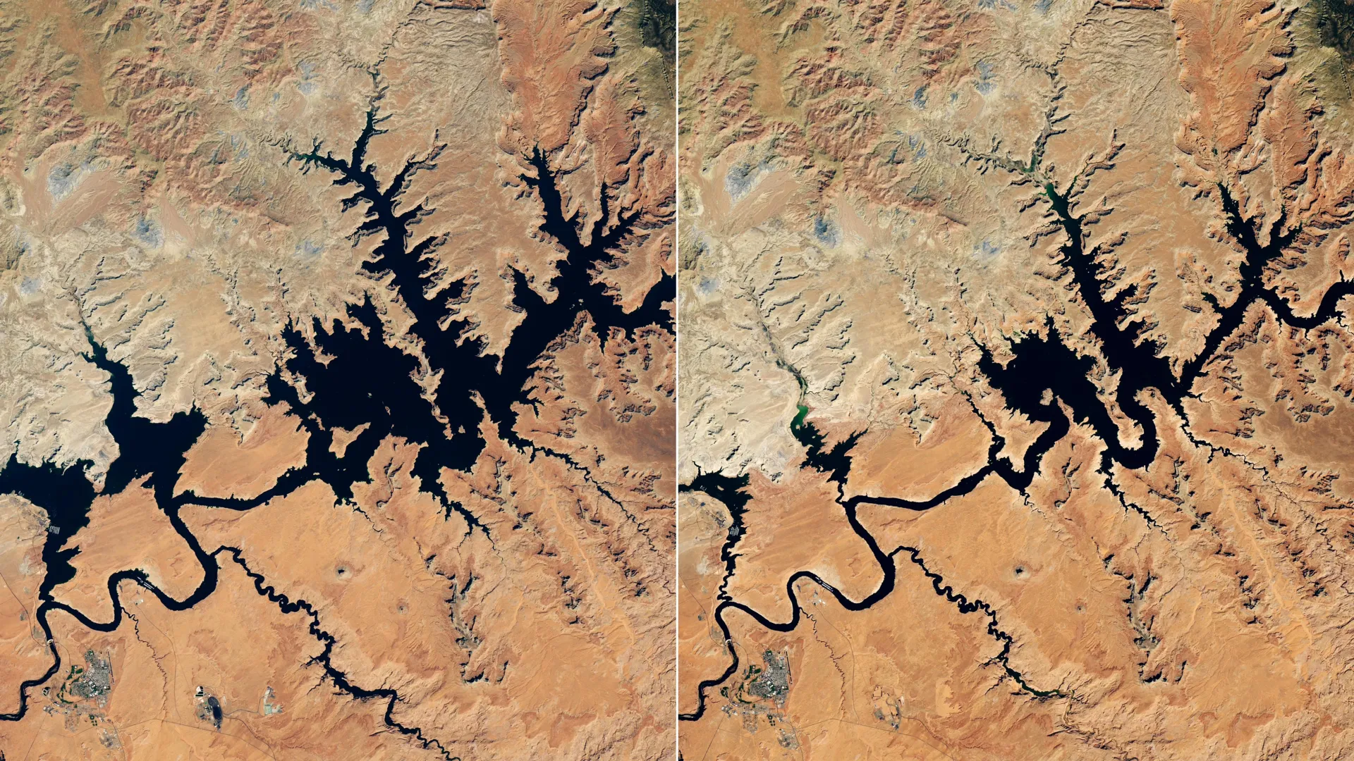
If you live in the Southwest, you might want to look at your water bill because the struggle is real. Lake Powell, the second-largest reservoir in the U.S., officially hit a record-low water level in late August and early September 2026. Satellite imagery from NASA’s Landsat 8 shows a super dramatic shift compared to its healthier years.
Why is this happening?
Real talk: it’s a snow drought. The winter of 2025-2026 was seriously lacking in snowfall across the Upper Colorado Basin. Normally, that mountain snowpack is the main character of the water supply—it melts in the spring and fills up the reservoirs. But with record warmth and very little snow, the water just didn't show up. It’s essentially a megadrought that’s been lingering since the start of the 21st century.
The scramble to fix it
The U.S. Bureau of Reclamation (USBR) has been working overtime to keep the water flowing. They’ve been releasing extra water from the Flaming Gorge Reservoir and cutting back on what gets sent downstream to Lake Mead. They even had to cancel a "controlled flood" meant for fish habitats just to save water. It's a major L for environmental efforts, but they're trying to keep the hydropower electricity flowing for the 40 million people who rely on this system.
How tech is helping
It’s not all doom and gloom—we’ve got some cool tech monitoring the situation. Researchers are using NASA-backed tools, like the Drought Severity Evaluation Tool and real-time dashboards for soil moisture, to help water managers make smarter decisions. It’s giving people on the ground better data to navigate this ongoing crisis.
Why it matters
Over 40 million people in cities like Las Vegas, Phoenix, Los Angeles, and San Diego depend on this river system, not to mention 5 million acres of farmland. When our water infrastructure starts hitting record lows, it’s not just a statistic—it’s a reminder that we’re in a long-term fight against a changing climate.